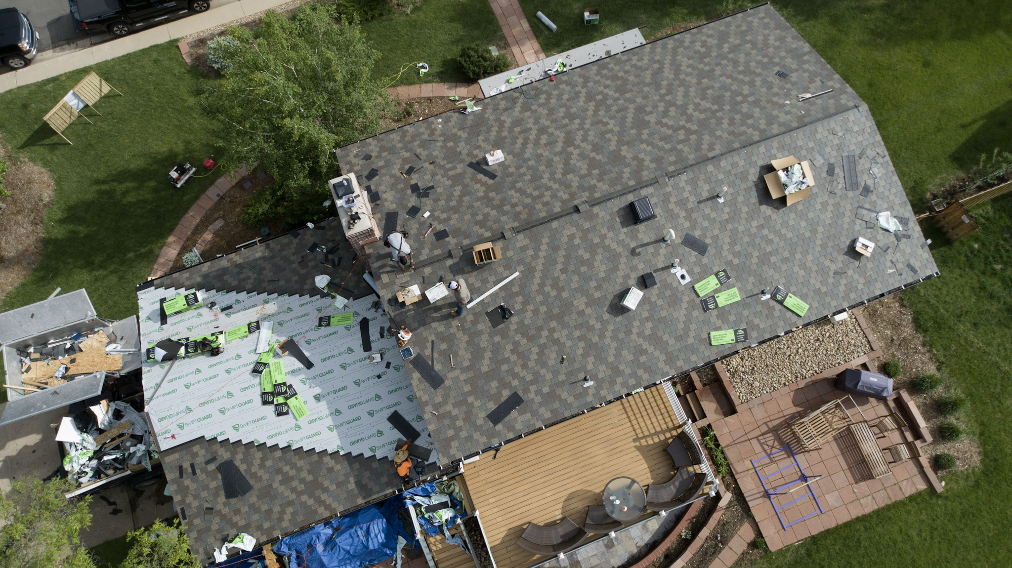
Why Drone Surveying and Mapping Are Revolutionizing Construction, Land Development, and Infrastructure Projects

The Future of Site Documentation Is in the Sky
Traditional land surveying methods have served the construction and engineering industries for decades. However, advances in drone technology are transforming how projects are planned, documented, and managed. Today, drone surveying and mapping provide faster, safer, and more accurate data collection than ever before.
Whether you’re a general contractor, civil engineer, land developer, architect, or property owner, drone technology can dramatically improve project efficiency while reducing costs.
At CTRL Creative Agency, we specialize in professional drone surveying, aerial mapping, construction progress documentation, and high-resolution site imaging to help businesses make informed decisions.
What Is Drone Surveying and Mapping?
Drone surveying uses unmanned aerial vehicles (UAVs) equipped with high-resolution cameras and specialized sensors to capture aerial imagery and geospatial data. This data is processed into detailed maps, models, and measurements that provide actionable insights for project teams.
Drone mapping services can produce:
- Orthomosaic maps
- 2D and 3D site models
- Topographic maps
- Digital surface models (DSM)
- Digital terrain models (DTM)
- Volumetric measurements
- Elevation data
- Stockpile calculations
- Construction progress reports
These deliverables provide stakeholders with an accurate representation of existing site conditions without requiring extensive manual field work.
Benefits of Drone Surveying for Construction Projects
1. Faster Data Collection
Traditional surveying can take days or even weeks depending on project size. Drone surveys can often capture hundreds of acres in a matter of hours.
This accelerated workflow allows contractors and project managers to receive critical information quickly, keeping projects on schedule.
2. Improved Job Site Safety
Construction sites can present numerous hazards, including unstable terrain, active equipment, steep grades, and confined spaces.
Drone technology minimizes the need for personnel to physically access dangerous areas, significantly reducing risk while still collecting precise data.
3. Highly Accurate Measurements
Modern drones paired with RTK (Real-Time Kinematic) or PPK (Post-Processed Kinematic) technology can achieve survey-grade accuracy.
Accurate site measurements help reduce costly errors during:
- Earthwork operations
- Utility planning
- Site grading
- Excavation
- Infrastructure installation
- Quantity verification
4. Cost Savings
Drone mapping reduces labor hours, minimizes repeat site visits, and provides ongoing project documentation.
The result is improved efficiency, fewer delays, and reduced overall project costs.
Industries That Benefit from Drone Mapping Services
Construction
Construction companies use drone surveys to:
- Track project progress
- Monitor subcontractor performance
- Document milestones
- Compare as-built conditions
- Improve communication with stakeholders
Land Development
Developers rely on aerial mapping to evaluate properties, assess terrain, and assist with planning future developments.
Civil Engineering
Engineers utilize drone-generated data for:
- Site analysis
- Design planning
- Infrastructure inspections
- Utility corridor mapping
Mining and Aggregate Operations
Drone technology allows operators to quickly calculate stockpile volumes and monitor material movement with exceptional accuracy.
Agriculture
Precision agriculture applications include:
- Crop health monitoring
- Irrigation analysis
- Field mapping
- Drainage assessments
Construction Progress Documentation With Drones
One of the fastest-growing applications for drone technology is construction progress documentation.
Routine aerial site captures provide project owners and contractors with a complete visual history of the build.
Benefits include:
- Monthly or weekly progress reports
- Stakeholder updates
- Marketing content
- Insurance documentation
- Dispute resolution
- Quality assurance verification
Aerial documentation creates accountability and transparency throughout every phase of construction.
Deliverables From Professional Drone Mapping Services
When partnering with a professional drone service provider, clients can receive:
Orthomosaic Maps
Georeferenced aerial maps stitched together from hundreds of high-resolution images.
3D Models
Detailed three-dimensional representations of job sites for planning and analysis.
Point Clouds
Millions of data points used for advanced engineering and design applications.
Elevation Models
Precise terrain information for grading and drainage planning.
Progress Reports
Recurring aerial documentation packages designed to keep projects on track.
Why Choose CTRL Creative for Drone Surveying and Mapping?
At CTRL Creative Agency, we combine advanced drone technology with strategic visual storytelling and construction industry expertise.
Our drone services provide actionable data that supports smarter decisions, improves communication, and documents every stage of your project.
We work with:
- General Contractors
- Developers
- Engineers
- Municipalities
- Commercial Property Owners
- Infrastructure Companies
- Small Businesses
Whether you need a one-time site survey or ongoing construction documentation, our team delivers professional aerial solutions tailored to your project’s needs.
Ready to Elevate Your Project?
Drone surveying and mapping are no longer optional technologies—they’re becoming essential tools for modern construction and development.
If you’re ready to improve efficiency, increase accuracy, and gain a better understanding of your project site, contact CTRL Creative Agency today.
Need drone surveying, aerial mapping, or construction documentation services? Contact CTRL Creative and take control of your project’s success.
Leave a Reply